UYaU.com » Canada » Vancouver » Sloquet Creek Hot Spring
UYaU.com » Canada » Vancouver » Sloquet Creek (Sloquette Creek) Hot Spring
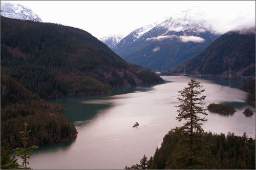
Sloquet Creek (Sloquette Creek) Hot Springs -- Wilderness hotspring
located near the north end of Harrison Lake. Several springs seep from
the rocks about Sloquet Creek (Sloquette Creek) and flow along the
ground before dropping over a short waterfall and forming a small pool
which is too hot for bathing. Several other springs percolate from the
ground, and volunteers have constructed small, natural-rock pools for
bathing along the creek. Sloquet Creek Hot Springs located about 80
kilometres south of Mt. Currie, near the Lillooet River and just
northwest of Harrison Lake.
Driving directions to Sloquet Creek (Sloquette Creek) Hot Springs
Start: Georgia & Burrard str., Vancouver, BC
Direction Road Comments Distance
Georgia St Georgia (NW) -> Lions Gate Br Rd
Lions Gate Bridge Rd (N) -> Marine Dr
Marine Dr (W) -> Taylor Way
Taylor Way (N) -> Hwy 1, Exit 13
Hwy 1 (W) -> Hwy 1, Exit 1 -> Hwy 99
Hwy 99 (N) Furry Creek Golf Course -> Pemberton Village
Hwy 99 (N) Pemberton Village -> Lillooet Lake
(Head east on Hwy 99 to Mt. Currie. Turn right at the Catholic Church in Mt. Currie.
Follow HWY 99 to the head of Lillooet Lake.)
Signs: In-Shuck-ch Forest Service Road
(Turn onto a gravel road. Total: 72.5 km.)
In-Shuck-ch Forest Service Signs -> Skookumchuch Hot Springs (St. Agnes)
Skookumchuck Hot Springs -> T-junction (with Stop Sign, around 29.8 km.)
(Approx 1hr to 1.5hrs driving.)
T-junction -> Sloquet Creek FSR (Around 4.2 km)
Sloquet Creek FSR -> Sloquet Hot Springs Campsite (Around 9.2 km)
(Road is not well maintained.)
How to drive and find Sloquet Creek (Sloquette Creek) Hot Spring:
1) Hwy 99 (N) Furry Creek Golf Course to Pemberton Village. Just can
see this below picture sign. You are still right way. Keep going...

Don't forget. There is big sign on your right side.

2) To right turns along a big sign in front of branch road.

3) This is a putty rock road, quite is difficult to walk. After meet
the first divided road, just drive to the right side way.
4) Then you can see the small yellow sign which is marked "kilometer"
number. After crossed 72 kilometer on the small yellow sign, there is
small road on your right side. Also there is a bridge - Tenas Narrows
Bridge.
5) After taken the about 10 kilometers road, you can see the hot
springs sign in the road left side. Take a little bit, you already find
the Sloquet Creek Hot Springs hot spring and CAMPSITE nearby hot spring.
Other hot spings in BC:
 Nakusp Hot Springs and
Campground truly is the place to relax, refresh and always return. Open
year round, Nakusp Hot Springs offers something for everyone. Enjoy the
soothing mineral waters, and kick back in British Columbia's cleanest
Hot Springs - where the waters are replenished daily.
Nakusp Hot Springs and
Campground truly is the place to relax, refresh and always return. Open
year round, Nakusp Hot Springs offers something for everyone. Enjoy the
soothing mineral waters, and kick back in British Columbia's cleanest
Hot Springs - where the waters are replenished daily.
Nakusp - British Columbia - Canada, VOG 1RO
Phone: (250) 265-4528
Pools are naturally heated Mineral Springs, kept at 100°F(38°C) and
107°F(41°C) in the winter and 97°F(36°) and 105°F(40°C) in the summer.
Canada's Top 10 Hot Springs
(Canadian Press Published: Friday, November 03,
2006)
Canada has about 140 hot springs - all of them located in western
mountain ranges - and in the latest issue of Canadian Geographic,
geochemist Steve Grasby lists his top 10 must-sees.
Grasby works for the Geological Survey of Canada and has studied many of the country's hot springs, which range in temperature from 20 to 89 degrees Celsius.
Here are his favourites:
- Banff, Alta.: The original pool, discovered by Canadian Pacific Railway surveyors in 1885, is not open to the public, but visitors can relax in a pool higher up Sulphur Mountain.
- Liard, B.C.: "A must if you're making the long drive north" along the Alaska Highway. Located in Muncho Lake Provincial Park.
- Rabbitkettle, N.W.T.: Accessible by float plane. Visitors must be accompanied by a warden from Nahanni National Park Reserve.
- Hot Springs Cove, B.C.: Located in Maquinna Marine Provincial Park on Vancouver Island. Can be reached from Tofino by float plane, boat or kayak. "Water tumbles down a rock face from cracks to create a hot shower."
- Larsen, Yukon: A deep pool at the perfect temperature for bathing.
- Meager Creek, B.C.: Popular spring near Pemberton, developed in the Japanese onsen style.
- Broken Skull, N.W.T.: Best accessed by helicopter. "A fantastic place to swim and enjoy the mountain scenery."
- Tungsten, N.W.T.: Springs discharge from the base of the "stunning" Mackenzie Mountains.
- Sloquette, B.C.: A hot-spring waterfall and several pools.
- Fording Mountain, B.C.: Strictly for science buffs, this spring has extensive microbial mats, with high sulphur concentrations. "Great for studying but not for soaking."
MT Baker Hot Springs in USA
Directions
From Exit 230 on Interstate 5, near past Mount Vernon, go east on State
Highway 20 (North Cascades Highway).
Just beyond the little town of Hamilton, but before reaching Concrete,
turn left on the Baker Lake Road.
Follow that road to baker Lake Resort, about twenty miles. Turn Left on
Forest Service Road No. 1144 (gravel and usually snow covered during
the winter) which goes about three miles to a widened parking area.
(It's by scenic outlook and you will come upon it by surprise.)
The trail, only about a quarter of a mile long, begins from the west
side of the parking area (opposite the view point). The trail is
unmarked, but take the left route from the parking lot. You will soon
find yourself on some planked walkway, assuring you that the hot
springs is a short distance away.